Subject: Quebec, Canada
Period: 1929 (published)
Publication:
Color: Printed Color
Size:
17.6 x 8.6 inches
44.7 x 21.8 cm
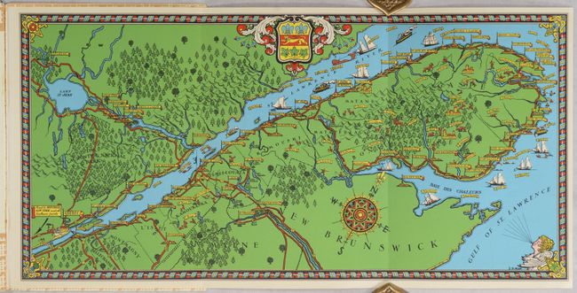
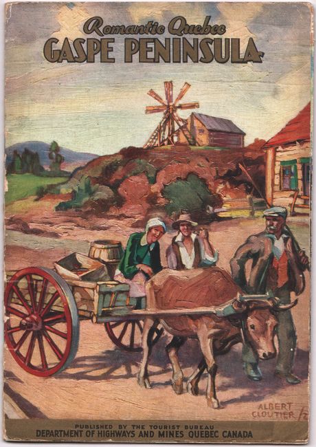
This tourist map by Samuel Herbert Maw is one of the earliest pictorial maps of Canada we have seen. It spans from Quebec City to the tip of the Gaspe Peninsula. Maw (1881-1952) was an English artist and architect who created several pictorial maps while living in Canada, most notably The City of Quebec (1932), a fine pictorial plan of the city influenced by MacDonald Gill. His map of the Gaspe Peninsula locates several towns and cities, each accompanied by a little architectural illustration and connected by roads delineated in red. The waters are filled with ships and notes of the kind of fishing to be found nearby. A fancy compass rose orients the north to top right. The map is further decorated by Quebec's coat of arms, a windhead, and an ornate border. It is attached to a 32-page illustrated booklet about the region, published under the direction of J.E. Perrault, the Minister of Highways and Mines for the province of Quebec. The painterly cover and illustrations within the booklet are by Canadian artist Albert Cloutier (1902-65). Later editions of the booklet replace Maw's map with a more prosaic rendering of the region.
References: Rumsey #11533.
Condition: B+
The map is issued folding and in near fine condition. The booklet is in good condition with one loose page and light wear to the covers.