Subject: St. Lawrence River, Canada
Period: 1761 (dated)
Publication:
Color: Black & White
Size:
34 x 22.1 inches
86.4 x 56.1 cm
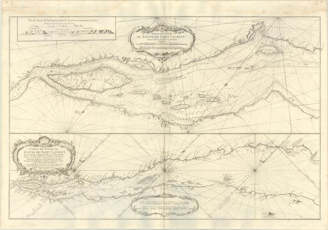
This sheet includes two horizontal charts that focus on the St. Lawrence River between the mouth of the Outardes River and Quebec. The upper map gives greater detail of the portion between Baie-Saint-Pauland Quebec. Both maps give extensive navigational information, including depth soundings, rocks, shoals, anchorages, and water currents. An inset at top left shows a land approach view between Grosse Isle and Ile-aux-Ruaux. Decorated with three rococo-style cartouches and rhumb lines.
References: Kershaw #650; Phillips (Atlases) #590.
Condition: B+
On a bright, sturdy sheet with a double-headed eagle watermark, light offsetting, several printer's creases at bottom center, light dampstains along the edges of the sheet, and a tiny tear at bottom center that has been closed on verso with archival tape. There are some grayish shadows along the bottom edge of the image that are caused by our scanner and do not appear on the map itself.