Subject: World
Period: 1746 (dated)
Publication:
Color: Hand Color
Size:
21.6 x 18.1 inches
54.9 x 46 cm
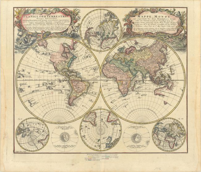
This handsome double-hemisphere world map was drawn by Georg Moritz Lowitz, based on the work of Johann Mathias Haas. It includes four polar spheres, each in a different projection, and two interesting diagrams depicting the earth, as it would be seen from space. North America has a speculative border above California with the recent discoveries of Bering and Tschirikow noted in 1741. The large, mythical Xarayes Lake appears in the center of South America. In the South Pacific there are partial coastlines of New Zealand, Australia, and Tasmania. Two very large, decorative cartouches contain the titles, one in Latin, the other French. The Latin cartouche features mythical sea creatures and wind heads while the other is surrounded by fruit and animals representing the bounty of the earth along with four headdresses representing the four continents.
This unique example includes a color-coded key below the map that has been pasted onto the sheet and corresponds to the larger world map. The color-coding identifies various religions around the world, which are grouped as Christian, Mohammedan and Pagan.
References:
Condition: A
A sharp impression with contemporary color in the map and later color in the cartouches. There is very minor soiling in the image and dampstains confined to the sides of the sheet.