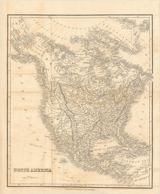
Subject: North America, Texas
Period: 1840 (circa)
Publication:
Color: Black & White
Size:
12.4 x 14.8 inches
31.5 x 37.6 cm
This densely engraved map of North America was published in Scotland. It features interesting territorial configurations, especially in the west. The Republic of Texas is shown in a smaller configuration with its northern boundary along the Rio Boco or Red R and the southern boundary along the Rio Grande. The Great Desert runs parallel to a slender New Mexico. A vast Missouri Territory dominates the center of the map, extending from Arkansas to present-day Montana. Fort Mandan and a Columbia Fur Company trading post are identified. The coastline between New California and Vancouver is labeled New Albion. The Pacific Northwest is named Western Territory and extends into present-day Canada. Conjectural rivers radiate from the lakes Timpanogos and Teguayo. Florida is still a territory and extends to Mobile Bay. Alaska is Russian Territory. Several tribal names appear throughout the map. Engraved by Johnstone.
References:
Condition: B
Issued folding with light toning and offsetting. An edge tear that enters 0.5" into map image at bottom has been closed on verso with hinge tape.