Subject: North America
Period: 1797-1812 (circa)
Publication:
Color: Black & White
A. A General Map of North America from the Best Authorities, by (Rev.) Jedidiah Morse, circa 1797 (8.8 x 7.4"). This small map of North America shows a mostly blank Great Basin and a long River of the West extending from the Entrance of Juan de Fuca eastward nearly to the Mississippi River. The map has good watershed detail, locates the source of the Mississippi River, and names some Indian tribes, forts, etc. Texas is located within the huge Louisiana Territory, but not delineated. Other interesting place names in the West include Quivira, Tecuayo, and New Albion. Engraved by Amos Doolittle. Published by Thomas & Andrews, Boston. Reference: McCorkle (18th C. Geography Books) #304-2. Condition: Issued folding on a bright sheet with a bit of printer's ink residue.
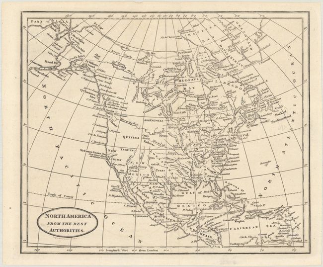
B. North America from the Best Authorities, by Benjamin Baker, circa 1812 (9.3 x 7.8"). This attractive small map still shows the United States confined to east of the Mississippi River with the large Louisiana to its west. The Oregan River originates roughly in Nebraska and flows as the River of the West to the Pacific at Puget Sound. Alaska is taking shape with some islands shown at the end of the Aleutian Peninsula. California is labeled New Albion and Quivira and Teguayo takes in most of the West. Condition: Issued folding on a bright sheet with a hint of offsetting.
References:
Condition: A
See description above.