Subject: Atlases, North America
Period: 1857 (published)
Publication:
Color: Hand Color
Size:
10.3 x 14.8 inches
26.2 x 37.6 cm
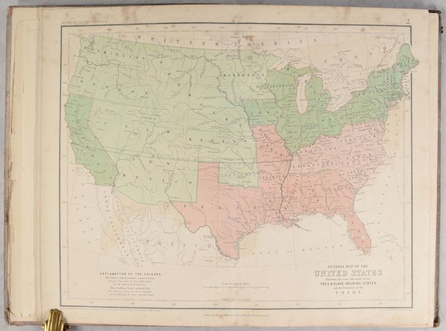
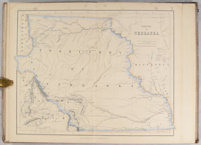
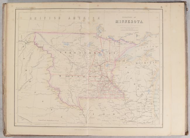
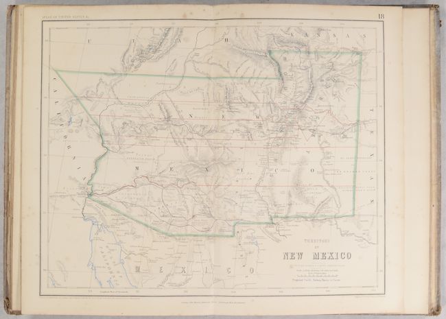
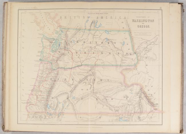
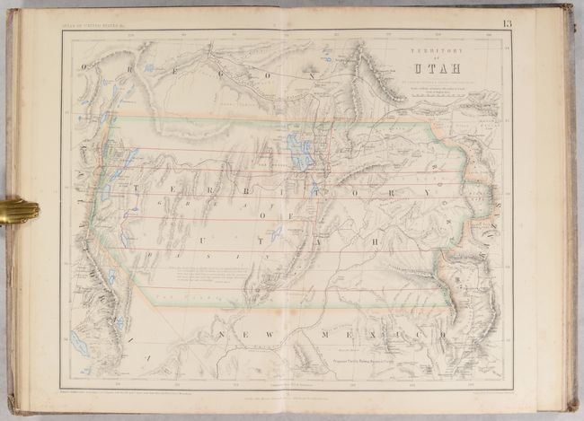
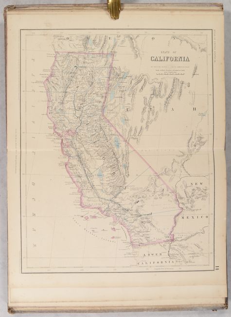
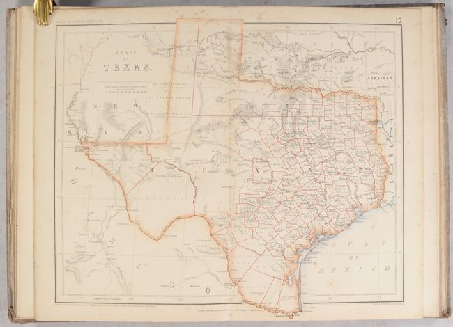
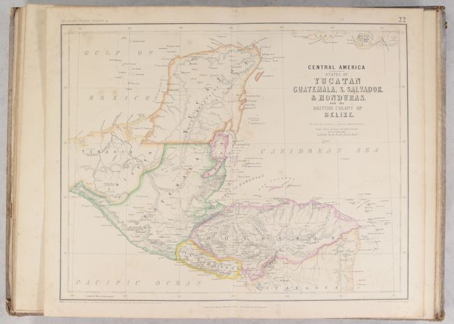
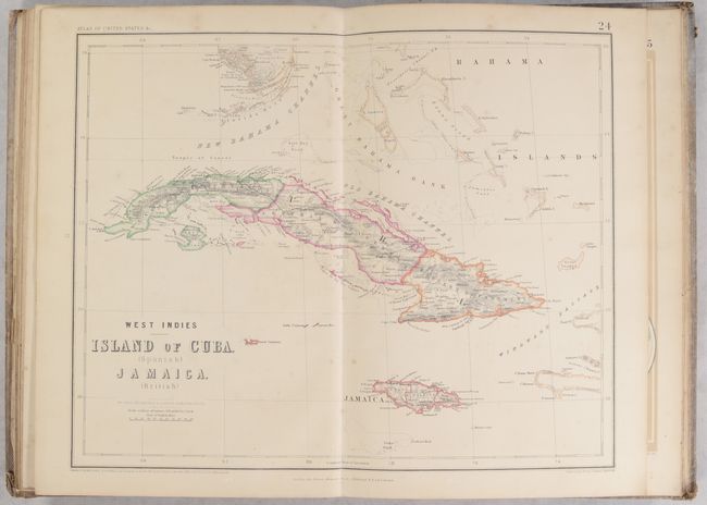
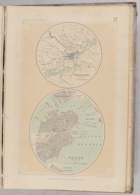
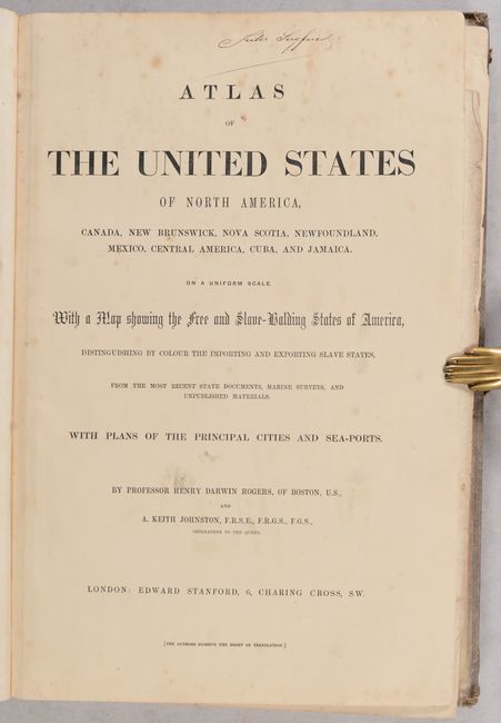
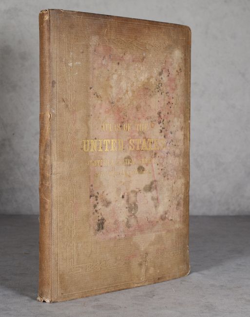
This important, complete and rare atlas was a collaboration between the British cartographer Alexander Keith Johnston and the American geographer Henry Darwin Rogers. Their combined efforts produced one of the finest groups of U.S. maps in the 19th century, most notably the outstanding maps of the western states and territories. There are 23 expertly rendered double-page maps, each with a crisp engraving and a combination of hand and lithograph coloring, plus the Index map. In the back of this terrific atlas are nine city plans printed on five sheets, Plates 25 - 29. (The plan of Charleston is attached to the pastedown, as issued.) The General Map of the United States delineates "Free and Slave Holding States," and has a key explaining which states exported, and which imported, slaves. The Territory of Nebraska is particularly eye-catching as it is tremendously detailed and encompasses the Dakotas, Montana, and Wyoming. Other important maps in this atlas include the Territory of Minnesota that shows early county configurations, Territory of New Mexico with details including mines, Indian villages, and ruins, and Territories of Washington and Oregon with numerous forts, Indian tribes, and early development west of the Cascades. The Territory of Utah has a long note in the map, credited to Fremont's Report, discussing the Great Basin's elevation, topography, and its numerous land-locked rivers and lakes. The inhabitants here are described as "savage tribes which no traveller has seen or described." This is certainly one of the rarest of all maps of the Utah Territory. The proposed route of the Pacific Railway is shown in purple and winds its way across the maps of the western U.S. Several of these maps appear in no other atlas, making this an exceptionally desirable production. Small folio, complete. Hardbound in tan cloth with embossed gilt titling on front cover.
References: Phillips (Atlases) #3670; Wheat [TMW], Vol. IV, p.66.
Condition: B
The maps are in good to very good condition, with contemporary outline color and light to moderate foxing. There is light dampstaining along the top edge of the first seven maps, and a few maps have light toning or minor color offsetting. The endpapers and title page are dampstained and soiled, and the table of contents is loose with several chips and tears. Text block is on the verge of separating from the covers. Covers are dampstained with some mildew spots and moderate shelf wear. The name of a previous owner, Jules Siegfried, is written in manuscript on the title page.