Subject: Atlases
Period: 1856 (circa)
Publication:
Color: Hand Color
Size:
16.8 x 19.1 inches
42.7 x 48.5 cm
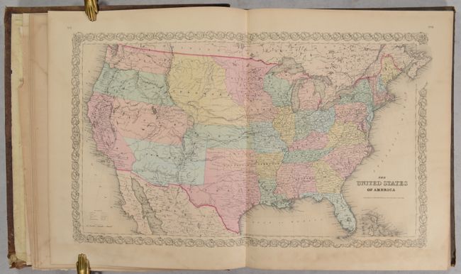
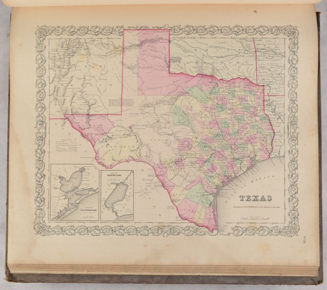
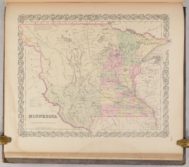
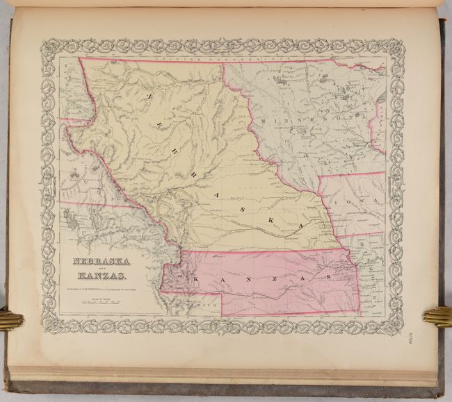
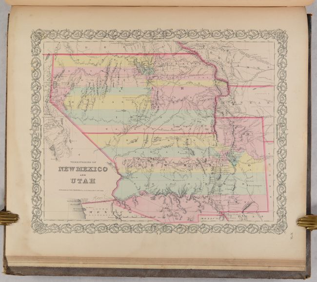
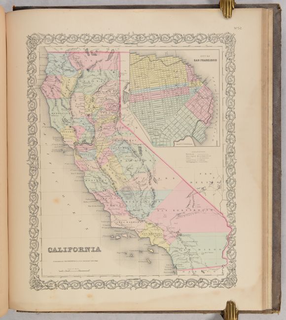
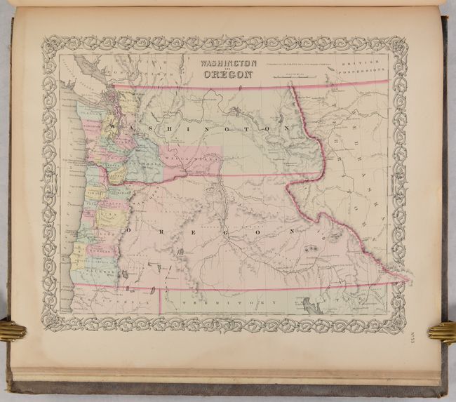
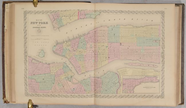
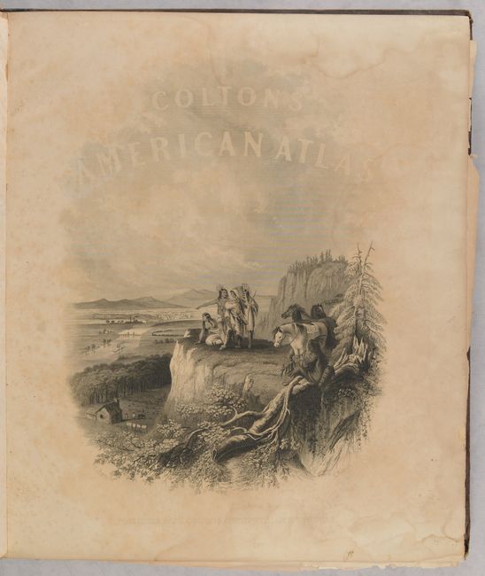
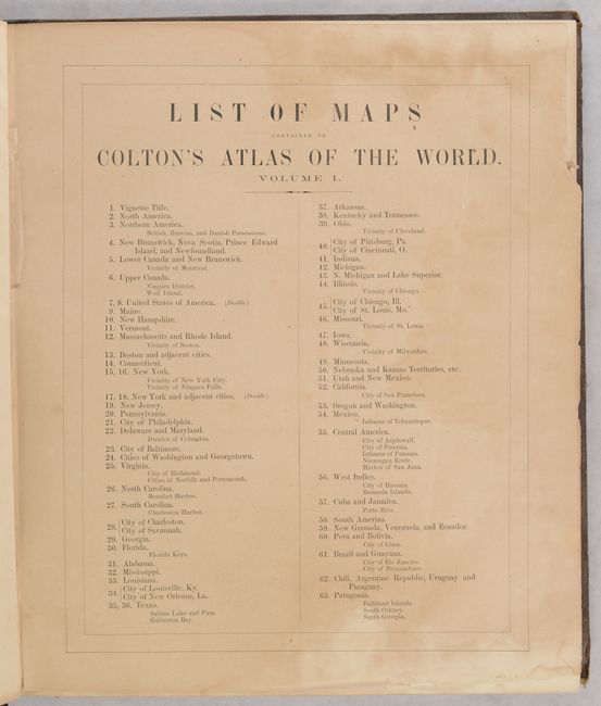
This is the first volume of Colton's two-volume folio atlas, containing all 59 maps/plans, each with Colton's decorative strapwork border. Volume I contains maps concentrating on the Western Hemisphere. 44 sheets relate to the United States, displaying 63 maps/plans, with numerous sought after single-page state maps - many with city insets. The maps of the United States and New York City are double-page maps (the table of contents notes Texas also as a double-page map, but is actually single-page). There are several great early western maps including: the U.S. map featuring Kanzas; the map of Texas with early county configurations; the early map of Minnesota showing its border on the Missouri River. Also present is the most desirable Nebraska and Kanzas map that depicts Nebraska stretching from Kansas to the Canadian border and bounded on the west by Washington and Oregon at the Continental Divide and Minnesota on the east. Includes the map of the territories of New Mexico and Utah, the California map with the large inset of San Francisco, and the territories of Washington and Oregon with their eastern boundaries on the Continental Divide and county development limited to the coastal areas. City plans included in Volume I are Montreal, Boston, New York (double-page), Philadelphia, Baltimore, Washington, Richmond, Norfolk/Portsmouth, Savannah/ Charleston, Louisville/New Orleans, Pittsburgh/Cincinnati, St. Louis/Chicago, Panama, Havana, Lima, Rio Janeiro, Pernambuco. This edition has the frontispiece showing Native American Indians overlooking a valley filled with frontier settlement and development.
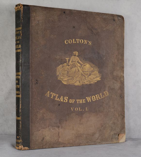
First edition with original brown cloth covers, quarter black leather with gilt banding and title on spine, and embossed gilt illustration on covers. Contains frontispiece, list of maps, text and tables. While the atlas is missing the title page, all of the called for maps are present.
References:
Condition: B+
Condition code is for the maps, which are very good with occasional scattered foxing and dampstains throughout that enter the borders (not the map images) at right and bottom. The list of maps is partially loose and half of the front endpaper is torn off. Text is lightly to occasionally moderately toned. Covers are worn and stained. Spine is chipped at the head and tail.