Subject: Colonial North America
Period: 1781 (circa)
Publication: Atlas Moderne Portatif
Color: Black & White
Size:
8.8 x 7 inches
22.4 x 17.8 cm
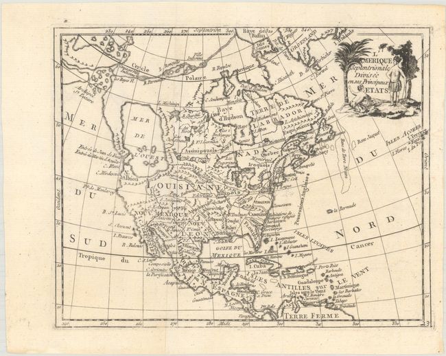
This uncommon small map of the continent shows the imaginary Mer de l'Ouest and a Northwest Passage stretching from Baffin Bay to the Archipel St. Lazare. There is not yet any sign of a recognizable Alaska. The British colonies are confined on the eastern seaboard with the huge French Louisiana territory stretching to the Pacific Northwest. Ft. Cenis is located in present-day Texas, and Habitations de Francois refugies appear above Charleston. The simple title cartouche features two Native Americans. The map is apparently based on Janvier's map of the same title.
References: McGuirk #169.
Condition: A
Issued folding on a clean sheet of watermarked paper with one small paper flaw that has been backed on verso with archival materials.