Catalog Archive
Auction 194, Lot 69

"Amerique Septentrionale", Bonne, Rigobert

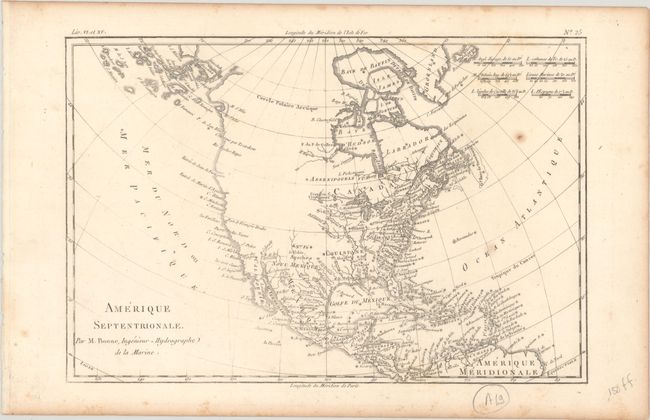
Subject: Colonial North America

Period: 1780 (circa)

Publication: Atlas de Toutes les Parties Connues du Globe Terrestre

Color: Black & White

Size:
12.8 x 8.5 inches
32.5 x 21.6 cm
Download High Resolution Image
(or just click on image to launch the Zoom viewer)

The entire western part of the continent is left mostly blank on this map of North America. Indian tribes occupy the edges of defined territory, including Apaches, Sioux, Outagamis, and Assenipouels. The British Colonies and a few major cities are named along the eastern seaboard and in the Great Lakes region. Alaska is shown as a group of islands, the largest of which is labeled Alaschka. Place names fill Mexico and the Caribbean.

References: Sellers & Van Ee #170.

Condition: B+

On watermarked paper with a few small spots and light foxing that is mostly confined to the blank margins.

Estimate: $120 - $150

Sold for: $90

Closed on 9/13/2023

Archived