Subject: Western Hemisphere - America
Period: 1817 (dated)
Publication:
Color: Hand Color
Size:
23.8 x 19.1 inches
60.5 x 48.5 cm
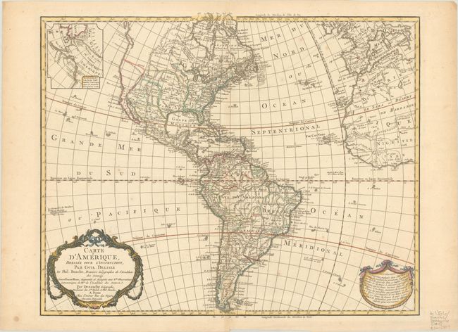
This is a later, updated edition of one of the most popular maps of the 18th century. It was first issued by Delisle in 1722 and went through 19 different versions according to Tooley. This is a version not mentioned by him, which would make it 20 versions. This edition was issued by Dezauche, the successor to the Delisle cartographic firm, and has been extensively updated through numerous revisions. The map includes the information from Cook's discoveries in the Northwest and Alaska in an inset "Supplement a la Partie Nord Ouest de l'Amerique d'apres les Decouvertes du Capitaine Cook." The United States extends to the Mississippi River in the west and to Florida in the south, with the unorganized Louisiana Territory not reaching the Pacific coast. The map shows a number of spurious mountains ranges in the West, going east to west and north to south, and sometimes doing both within the same range. A garland style title cartouche and another cartouche containing an advertisement decorate the lower corners.
References: cf. Tooley (America) p. 16, #17 & 18.
Condition: B+
A crisp impression on a sheet with the watermarks of "BAR" and rosary beads. There is light foxing, a bit of toning along the centerfold, and some small worm holes that have been archivally repaired on verso.