Subject: Holy Land
Period: 1750 (dated)
Publication:
Color: Hand Color
Size:
21 x 17.8 inches
53.3 x 45.2 cm
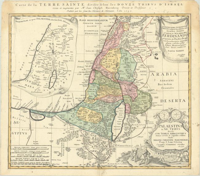
This beautifully engraved map divides the Holy Land into the twelve tribes. It covers the coastline from Biblus nunc Gibele to the Sirbonis lacus. A map showing the region in Roman times is inset in a decorative scroll at left, and the title cartouche is topped with two sides of a shekel coin. Below the cartouche is a scene of the encampment of the Jews with two spies of Moses bearing the fruit from the Promised Land. The map was drawn by Johann Christoph Harenberg. French title in top margin, "Carte de la Terre Sainte Divisee Selon les Douze Tribus d'Israel…"
References: Laor #325.
Condition: B+
A sharp impression with full contemporary color on a sheet with the watermark of Elias Kutter. There is a small worm hole in the bottom margin and light dampstains in the top corners of the sheet, just entering the map border.