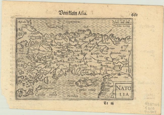
Subject: Turkey & Cyprus
Period: 1612 (circa)
Publication:
Color: Black & White
Size:
4.9 x 3.4 inches
12.4 x 8.6 cm
Charming miniature map of Turkey including Crete and Cyprus showing major towns and rivers. Strapwork title and distance scale cartouches and a sea monster. German text on verso, published in either 1612 or 1650.
The map was first published by Cornelius Claesz and printed by Barent Langenes in the 1598 edition of the popular Map-Treasury. For the 1599 edition, graduation lines and latitude numerals were added to one side of the border on most of the maps, which were again used for multiple editions through 1650. This is the second state with the added graduation lines.
References: King (2nd ed.) p. 80-82; Van der Krogt (Vol. III) #8110:341.
Condition: A
One faint spot on map below Cyprus and a torn corner in the bottom margin.