Subject: Western Germany
Period: 1659 (circa)
Publication:
Color: Hand Color
Size:
19.5 x 15 inches
49.5 x 38.1 cm
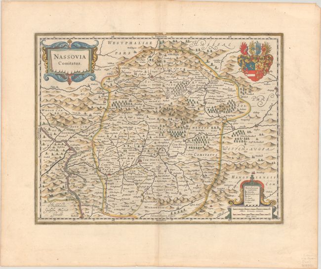
This is a lovely map of the county of Nassau covering the region between Koblenz in the west and Giessen in the east, and between Wiesbaden in the south and Olpe in the north. The Rhine River flows across the southwest corner. The map is richly embellished with decorative title and distance scale cartouches and the coat of arms of Nassau nobility. This map was originally designed by Jodocus Hondius and engraved by Salomon Rogiers. After Hondius' death in 1629, the plate was acquired by Blaeu who deleted Hondius' name and added his own to the imprint at lower left. Spanish text on verso, published between 1659-72.
References: Van der Krogt (Vol. I) #2390.2.2.
Condition: A
A nice impression with full contemporary color on a bright sheet with a large watermark of the god Atlas and a couple of archivally repaired worm holes in the top border of the map with minor loss of image.