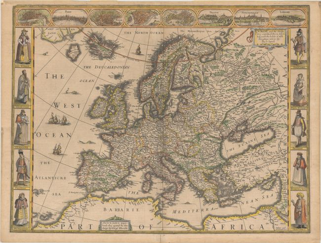
Subject: Europe
Period: 1626 (dated)
Publication: A Prospect of the Most Famous Parts of the World
Color: Hand Color
Size:
20.2 x 15.4 inches
51.3 x 39.1 cm
This is one of the most beautiful carte-a-figure maps of Europe, surrounded with vignettes on three sides. The upper frieze has eight bird's-eye views of London, Paris, Rome, Constantinople, Venice, Prague, Amsterdam, and Lisbon. The side borders contain the costumes of the noblemen and women of ten European nations. The map shows the well-detailed but fictitious island of Frisland just off the coast of Iceland, and the seas are alive with sea monsters and ships. Beautifully engraved by Abraham Goos and published by George Humble between 1627-32. Related English text on verso.
References: Shirley (BL Atlases) T.SPE-2a #4.
Condition: B+
A nice impression on a lightly toned sheet with a bunch of grapes watermark. There is modern paper adhered along the top sheet edge on verso from a previous framing, and a centerfold separation in the bottom blank margin has been closed on verso with old paper.