Subject: Iceland
Period: 1767 (dated)
Publication:
Color: Black & White
Size:
32.9 x 21.6 inches
83.6 x 54.9 cm
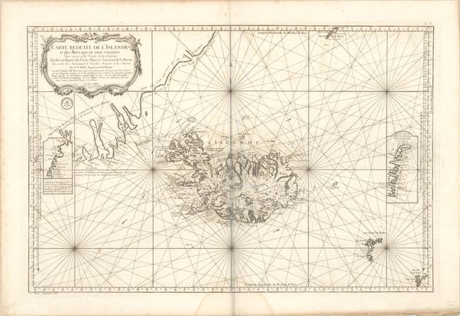
In 1752 the Danish scholar Niels Horrebow published an important book and map covering Iceland. His map, based on the previously unpublished Knoff survey, was a major departure from previous maps based on Bishop Gudbrandur Thorlaksson's map of more than 150 years earlier. Thus, it marked a turning point in the cartography of Iceland. This is Bellin's large-scale map focusing on the island and extending to include a portion of the coastline of Greenland. The map locates villages and churches and graphically delineates the mountains, rivers, lakes, forests, and an erupting Mt. Hekla. There are notations adjacent to several villages explaining what types of provisions can be found. The inset at right shows the eastern coastline of Iceland based on a Dutch chart, and the inset at left shows a portion of the western coastline based on the remarks of French naval officer Kerguelen. The engraved stamp of the Depot de la Marine is below the title, and the price is at bottom left: "Prix Cinquante Sols." Engraved by Croisey.
References:
Condition: B+
A dark impression on a bright sheet with a large eagle watermark, light offsetting, an extraneous crease adjacent to the centerfold, a couple of spots of foxing, and a dampstain at bottom center.