Subject: Eastern Hemisphere
Period: 1753 (dated)
Publication: Hedendaagsche Historie
Color: Black & White
Size:
14.3 x 12.5 inches
36.3 x 31.8 cm
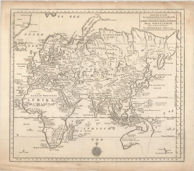
This finely engraved map of the Eastern Hemisphere provides an excellent view of the still evolving cartography of the Far East. The depiction of East Asia includes an extended landmass beyond the Kamchatka Peninsula, as well as the outdated ideas of Kompagnies Land and Land Jeso. The islands of the Philippines and Indonesia are not well shaped, and Australia is a very odd shape that incorporates New Guinea, with most of the southern and eastern coastlines shown as dotted lines. The interior of Africa is mostly blank with the Nile's source correctly located. A lovely 32-point compass rose decorates the map at bottom.
References:
Condition: B+
A nice impression, issued folding on a sheet with a bunch of grapes watermark, a spot near the British Isles, and light toning and soiling that is mostly confined to the edges of the sheet. There is extraneous creasing along the edges of the sheet.