Subject: Texas & Louisana
Period: 1903 (published)
Publication:
Color: Printed Color
Size:
10.5 x 7.9 inches
26.7 x 20.1 cm
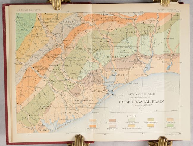
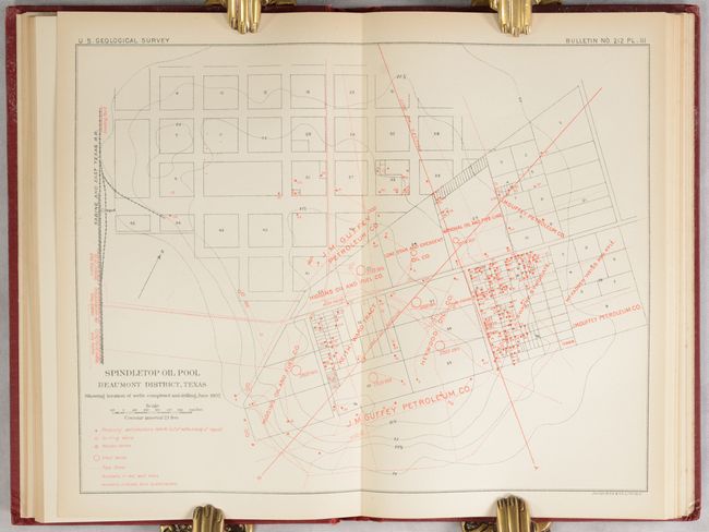
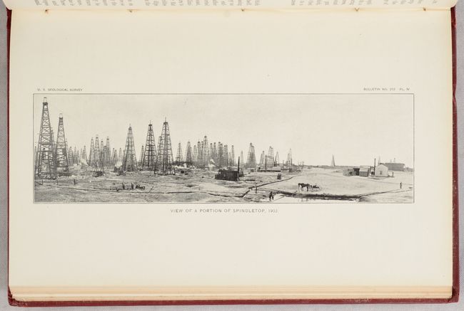
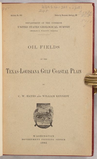
This 174-page report by C.W. Hayes and William Kennedy was published as a result of the discovery of oil at Spindletop, Texas by Captain A.F. Lucas in January 1901. As a result of this discovery, there was strong demand for geological information of the region, and the USGS determined "that the interests of the oi-producing industry would be best served by a thorough study of the stratigraphy of the region and the collection of all data regarding the character of the underlying beds." The report covers the topography and geology of the Gulf Coast Plain, the geology of the various oil pools including Spindletop, and the origins of Gulf Coastal Plain oil. Illustrations of note include Geological Map of a Portion of the Gulf Coastal Plain (10.5 x 7.9"), Spindletop Oil Pool Beaumont District, Texas..., (10.0 x 7.8"), and “View of a Portion of Spindletop, 1902.” Hardbound in modern cloth with gilt title on spine and original front wrapper bound in.
The Spindletop discovery ushered in the oil age. This is an early, and possibly first, government report on the discovery and early exploration in the Gulf area.
References:
Condition: A
Contents have a hint of pleasant light toning. There is an old Library of Congress (surplus) stamp on the rear endpaper. Modern binding has minor wear with bumped corners.