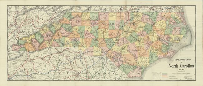
Subject: North Carolina
Period: 1909 (dated)
Publication:
Color: Printed Color
Size:
54.6 x 22.1 inches
138.7 x 56.1 cm
A very large and attractive map of the state that extends into portions of northern South Carolina, eastern Tennessee and southern Virginia. Counties within North Carolina are colored and the lines of the Atlantic Coast Line (green), Seaboard Air Line (blue), Southern Railway (red), Norfolk & Southern (orange), and other lines (purple) are identified throughout. Prepared for the North Carolina Corporation Commission by Henry C. Brown. We found no past sales records for this map and only two institutional examples on OCLC.
References:
Condition: B+
Very clean and colorful with a few tiny holes along two folds between Raleigh and Henderson.