Subject: World, World War II
Period: 1943 (dated)
Publication:
Color: Printed Color
Size:
35.4 x 14.9 inches
89.9 x 37.8 cm
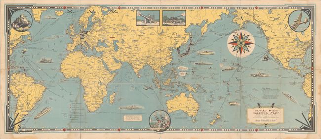
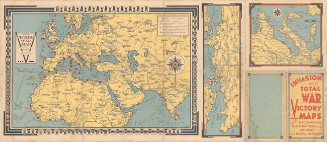
This elaborate wartime map is centered on the Pacific theater of war. It locates numerous Allied naval bases, railroads, British & French colonial possessions, and the Axis power countries in menacing black. The oceans are filled with illustrations of Allied military power including ships, submarines, and aircraft with distances between various ports noted. Illustrations along the border feature "A Yank Tank", "Flying Fortress", and a "New Anti Aircraft Gun Machine." Chase describes his production as "A Battle Map, to set the stage for 'total war' on land and sea; And, in the border, just a hint - A prayer - for total Victory!" The verso contains three smaller maps: Europe, English Channel, and the region around Italy. Self-folding (4.5 x 8.0").
References:
Condition: B
Issued folding with light dampstains along a couple of the lower folds. There are several short fold separations mostly along the horizontal fold with some minor loss.