Subject: Eastern Maryland
Period: 1947 (dated)
Publication:
Color: Printed Color
Size:
15.9 x 21.4 inches
40.4 x 54.4 cm
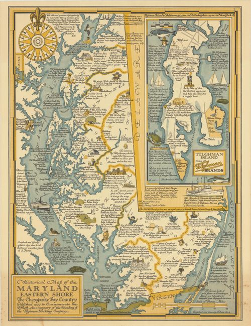
This tourist map of the eastern shore of Maryland was published as an advertising piece for Tilghman Packing Company. The company was founded in 1897 on Tilghman Island in the Chesapeake Bay, and during its heyday it was the largest employer in the county. This map was created by Edwin Tunis to commemorate the 50th anniversary of the company's founding, and is filled with historical facts. A large inset of Tilghman Island obscures Delaware, noting the location of the original Tilghman Packing Company plant. The company closed operations in 1975.
References: cf. Hornsby (Picturing America) #92.
Condition: A
A crisp example with minor foxing mostly in the bottom blank margins and light toning along the sheet's edges.