Subject: Western Hemisphere - America
Period: 1826 (dated)
Publication:
Color: Hand Color
Size:
27.3 x 20.1 inches
69.3 x 51.1 cm
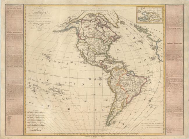
This uncommon copper-engraved map of the Western Hemisphere showcases the discoveries of Cook, Mackenzie, and Vancouver, delineating the tracks of Cook's voyages. Based on the cartography of Rigobert Bonne, this map is a corrected and updated version of a large map first published by Basset in 1795. It is flanked by panels of text describing the various countries and regions, noting that Louisiana had been ceded to the United States in 1803. There is nice topographical detail, and several Indian tribes and towns and cities are named in the Americas. Present-day Texas, California, and the rest of the American Southwest are still under Spanish control. The Arctic passage of Cluny in 1768 is delineated. At top right is an inset of Hispaniola. Eight distance scales fill the bottom left corner.
References:
Condition: B+
A nice impression on a sheet with the watermarks of rosary beads and "LVD." There is light toning, soiling, and a stain in the distance scales. There are archival repairs to some chips and tears along the edges of the sheet.