Subject: Western Hemisphere - America
Period: 1811 (dated)
Publication: New Universal Atlas
Color: Hand Color
Size:
20.7 x 18.3 inches
52.6 x 46.5 cm
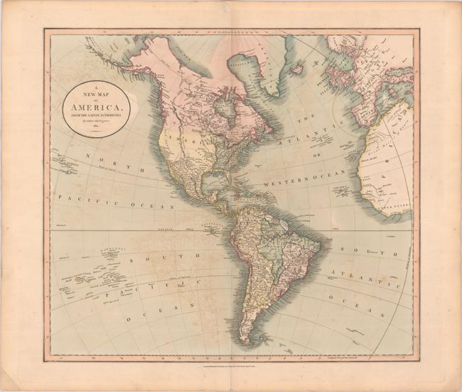
An attractive map of the Americas with the United States confined to east of the Mississippi River. Louisiana occupies the region to the west of the Mississippi with a Pawnee Village located at "The most Northern bend of the Missouri Rios." Beyond the Missouri, the region is nearly blank save for the Stony Mountains and a few speculative rivers. Alaska is coming into form and the Aleutian Islands are well developed. The map extends to show all of South America, the Sandwich and Dangerous Archipelagos, western Europe, and northwestern Africa.
References:
Condition: B+
Issued on 1811 watermarked paper with light offsetting and a short centerfold separation confined to the bottom blank margin.