Subject: Western Hemisphere - America
Period: 1795 (circa)
Publication:
Color: Hand Color
Size:
8.8 x 9.5 inches
22.4 x 24.1 cm
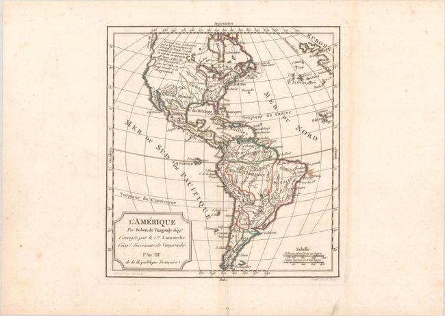
This handsome small map of the Americas is based on Robert de Vaugondy's map of the same title (1762). The western coast of North America is truncated with a partial coastline and a notation indicating a possible Northwest Passage per the supposed discoveries of Admiral de Fonte. In an update from the Robert de Vaugondy original, Captain Cook's new discoveries in the Pacific Northwest are noted as well. The British Colonies are confined east of the Mississippi River. Engraved by E. Dussy.
References:
Condition: B+
A nice impression on a sheet with a "G [heart] I" watermark. There is a small light stain off the coast of Brazil and a hint of soiling in map image. There is some archival reinforcement of the centerfold on verso.