Subject: Southern Africa
Period: 1755-88 (circa)
Publication:
Color: Black & White
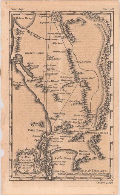
A. A Map of the Cape of Good Hope & the Country Adjacent. 1752, by John Gibson, from Gentleman Magazine, published 1755 (4.6 x 7.4"). Great little map of the region between St. Helena Bay and False Bay and Cape showing the early settlements, tribal lands, and terrain. Locates Swarte Land, Hottentot Holland, Frans Hoeck, and more. Shows the triangulation from La Caille's survey of 1752. There is a decorative title cartouche at lower left. Distance scale is in the French units of Toises. Before France adopted the metric system in 1799 the toise was the French equivalent of the fathom and was used in both land measurement as well as to express water depth. Published in the November 1755 issue of the Gentleman's Magazine.
Nicolas Louis de La Caille (1713 - 1762) was a French astronomer who is remembered for his workcataloging nearly 10,000 stars, including 42 nebulous objects. His numerous publications and accomplishments included the introduction of 14 new constellations and calculating a table of eclipses 1800 years into the future. On the moon the crater La Caille is named after him. At the Cape Lacaille wanted to test Newton's theory of gravity and thus verify the shape of the earth. In South Africa he setup a baseline north of Darling then measured a 90 mile arc of meridian between Cape Town and Aurora. His results suggested an egg-shaped earth. Over 80 years later Thomas Maclear, the Astronomer Royal at the Cape, repeated the measurements. He discovered the earlier measurements had failed to take account for the gravitational effect from the nearby mountains, thus restoring the earth to a proper oval shape. Reference: Jolly #GENT-92. Condition: Lightly toned with minor offsetting from an opposing page of text.
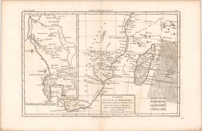
B. Carte du Canal de Mosambique, Contenant l'Isle de Madagascar avec les Cotes d'Afrique, Depuis le Cap de Bonne Esperance Jusqu'a Melinde, by Rigobert Bonne, circa 1788 (12.4 x 8.3"). This copper engraved chart delineates the southern and southeastern portions of Africa from the Cape of Good Hope to Zanzibar, including Madagascar. There is minimal inland detail except for the names of several tribes. At left is a large, detailed inset map of the region between the Cape of Good Hope and St. Helena Bay. The trade winds are graphically depicted in the Indian Ocean. Engraved by Dien. Condition: A crisp impression with minor offsetting, a faint dampstain in the title cartouche, and a hint of toning along the centerfold.
References:
Condition: B+
See description above.