Subject: Philippines, World War II
Period: 1944 (published)
Publication:
Color: Printed Color
Size:
15.4 x 20.1 inches
39.1 x 51.1 cm
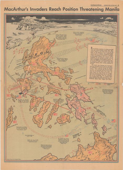
This World War II map of the Philippines was drawn by Charles Owens and issued in the December 25, 1944 issue of the Los Angeles Times. The sweeping map covers the area from Mindanoa to Luzon with a view at the top of Bataan, Corregidor and across Manila Bay to Manila in Owen’s distinctive style. It shows the progress of the invasion, lines of attack and supply with text explanation and relief shown pictorially. The invasion in January was successful in liberating Luzon and Manila. See the Rumsey reference for Owens’ earlier map of the invasion launch issued on October 23rd.
References: cf. Rumsey #11029.
Condition: B+
Printed on newspaper with light toning and a couple of edge tears closed on verso with archival tape.