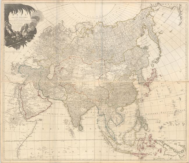
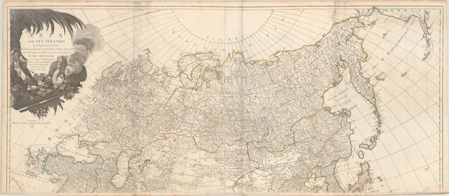
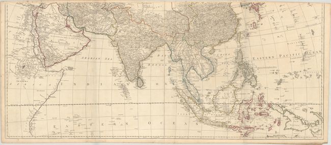
Subject: Asia
Period: 1794 (dated)
Publication:
Color: Hand Color
Size:
47.4 x 20.4 inches
120.4 x 51.8 cm
A superb, large-scale map based on the work of the famous French cartographer Jean Baptiste Bourguignon d'Anville. It provides an extremely detailed view of the continent and extends to include all of South East Asia and numerous islands of the Pacific, with emphasis on English exploration. The discoveries of Captain Cook appear in the Aleutian Islands (Foxes Islands) and the Northeast coast of Asia. Hokkaido is featured as an archipelago named Isles of Yeso, including the Three Sisters. The Carolines are accurately depicted on an east-west axis. The large decorative cartouche features an Asian merchant, his exotic goods, and a camel. This example is joined in two long, horizontal sheets, joining the two northern and the two southern sheets. If fully joined, the map would measure 47.4 x 40.4".
References:
Condition: B+
Contemporary outline color, issued folding on sheets with a Strasbourg Lily watermark, light soiling, minor toning, and a few short edge tears. The north western sheet was completely separated along the fold and has been reattached on verso with tape. The first image is a composite image - the map is in two long, horizontal sheets.