Catalog Archive
Auction 193, Lot 584

"Nieuwe Zeekaart van de Straat van Gibraltar…", Tirion, Isaac

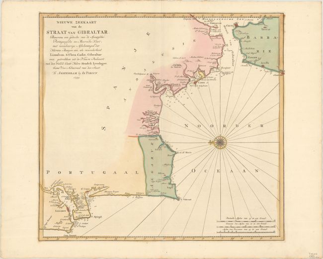
Subject: Strait of Gibraltar

Period: 1759 (dated)

Publication: Nieuwe en Beknopte Hand Atlas

Color: Hand Color

Size:
16.5 x 15.3 inches
41.9 x 38.9 cm
Download High Resolution Image
(or just click on image to launch the Zoom viewer)

Lovely sea chart of the Strait of Gibraltar with the Spanish and Portuguese coastline up to Lisbon, and the northern most tip of Morocco. The map is oriented with north at left by a beautiful compass rose. The map is based on the surveys by the Dutch navigator Hendrik Lynslager.

References:

Condition: A+

A crisp impression with full contemporary color on a bright sheet with an "I. Villedary" watermark.

Estimate: $200 - $230

Sold for: $100

Closed on 6/21/2023

Archived