Subject: Northwestern Poland & Northeastern Germany
Period: 1663 (circa)
Publication: Le Grand Atlas
Color: Hand Color
Size:
19.4 x 14.9 inches
49.3 x 37.8 cm
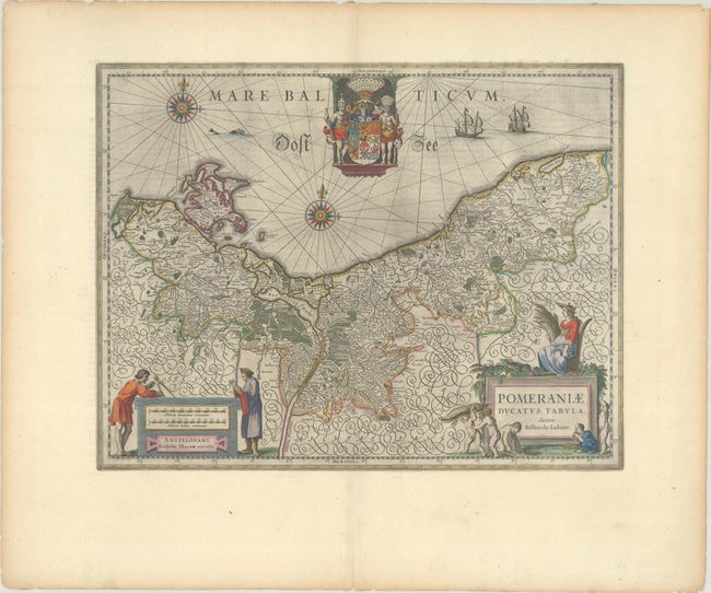
Stunning map of the historic region of Pomerania on the shores of the Baltic Sea, extending west past Straslund and the island of Rugen. This region had been variously annexed by Sweden and Prussia over the years and is today primarily in Poland with a portion controlled by Germany. The map is based on the surveys of Eilhard Lubbin and engraved by S. Rogiers. Two decorative cartouches, an elaborate coat of arms, two compass roses and sailing ships decorate this map. French text on verso.
References: Van der Krogt (Vol. II) #2190:2.2.
Condition: A
A dark impression with full contemporary color on a bright sheet with wide margins, printer's ink residue, and light toning and tiny tears along the edges of the sheet.