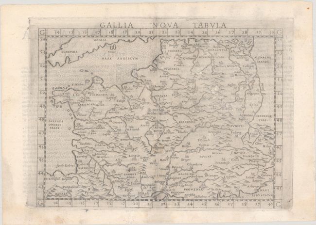
Subject: France
Period: 1574 (circa)
Publication: La Geografia di Claudio Tolomeo Alessandrino...
Color: Black & White
Size:
9.7 x 7.1 inches
24.6 x 18 cm
This map is the modern map of France from Ruscelli's edition of Ptolemy's Geografia. It is a terrific example of Italian copperplate engraving, with mountains and rivers with tiny castles representing the cities. It extends into Belgium and shows small portions of Spain and Germany. Italian text on verso.
References: Mickwitz & Miekkavaara #220-31.
Condition: B
A dark impression on watermarked paper with printer's ink residue and professional repairs to small wormholes and a chip along the centerfold, with a portion of the border and map replaced in facsimile at bottom. There is light soiling that is mostly confined to the margins.