Subject: Western Ireland
Period: 1610 (dated)
Publication: Theatre of the Empire of Great Britaine
Color: Hand Color
Size:
20.3 x 15.3 inches
51.6 x 38.9 cm
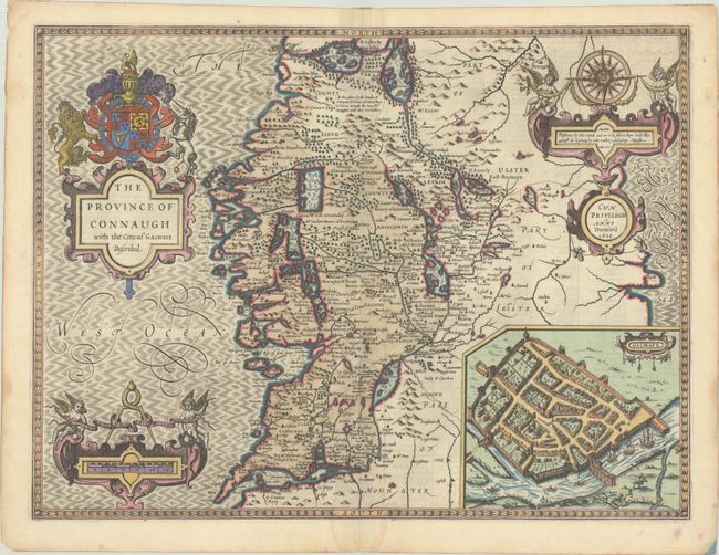
This beautiful and detailed early map of the province of Connacht includes the counties of Galway, Clare, Sligo, Mayo, Roscommon and many cities, towns and topographical details. The fortified city of Galway is shown in a large inset with the Galway River flowing by, complete with boats and ships. The seas are fully engraved and filled with fancy lettering. The map is adorned with three extravagant cartouches: one for the title, topped with English and Irish heraldry; one for the scale of Irish miles with a pair of cherubs; and an especially dramatic one suspended from an elaborate compass rose with more cherubs and strapwork decoration. The map has the imprint of John Sudbury and George Humble, indicating it was published circa 1614-23. The verso contains related English text describing the history and people of the region.
References: Shirley (BL Atlases) T.SPE-1
Condition: B+
A sharp, early impression on a bright sheet with a small bunch of grapes watermark and light dampstains along the centerfold.