Catalog Archive
Auction 193, Lot 434

"Ultoniae Orientalis Pars", Mercator/Hondius

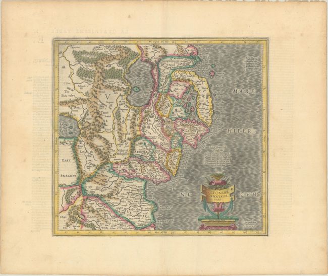
Subject: Northern Ireland

Period: 1628 (circa)

Publication: Gerardi Mercatoris - Atlas sive Cosmographicae…

Color: Hand Color

Size:
14.9 x 13.7 inches
37.8 x 34.8 cm
Download High Resolution Image
(or just click on image to launch the Zoom viewer)

Superb early map covering Down and Antrim Counties in Northern Ireland. This was one of five Irish maps Gerard Mercator designed for the second part of his Atlas. It is beautifully engraved with a moiré pattern in the sea, strong topographical features in the interior, and ornamented with a title cartouche incorporating the distance scale. French text on verso, published in 1628 or 1633.

References: Law, p. 21; Van der Krogt (Vol. I) #5941:1.1.

Condition: A

Full contemporary color on a watermarked sheet with a few tiny abrasions along the centerfold and marginal toning and soiling.

Estimate: $240 - $300

Sold for: $180

Closed on 6/21/2023

Archived