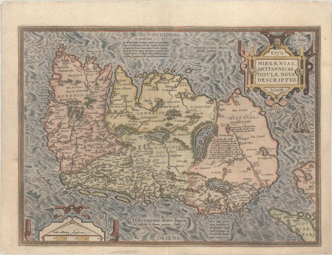
Subject: Ireland
Period: 1598 (published)
Publication: Theatrum Orbis Terrarum
Color: Hand Color
Size:
19 x 14 inches
48.3 x 35.6 cm
This exceptional map was based on Mercator's 1564 wall map of the British Isles and is presented with west oriented to the top. This is the first map of Ireland to include any geographic details; its predecessors being crudely drawn Italian maps. It is divided into counties and shows towns, rivers, lakes, forests, coastal islands and a host of other details. There are several Latin annotations throughout the map. The map is typical of Ortelius' refined, yet ebullient style with bold strapwork title and scale cartouches and a pair of ships in the stormy sea off the northern coastline. Dutch text on verso.
References: Law, pp 6-9; Van den Broecke #22.3.
Condition: A
A nice impression on a sheet with the crossed arrows watermark commonly found on Ortelius maps. There is an expertly repaired centerfold separation that just enters map border at bottom and light soiling in blank margins. The margins have been slightly trimmed, but are still ample.