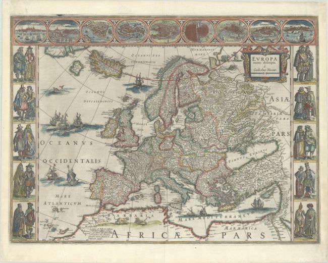
Subject: Europe
Period: 1643 (circa)
Publication: Theatre du Monde ou Nouvel Atlas
Color: Hand Color
Size:
22 x 16.3 inches
55.9 x 41.4 cm
This classic map of Europe is presented in the carte-de-figures style with vignettes on three sides. The upper frieze has nine bird's-eye views of Amsterdam, Prague, Constantinople, Venice, Rome, Paris, London, Toledo and Lisbon. The side borders contain the costumes of the noblemen and women of ten European nations. The map is embellished with sailing ships, sea monsters, bears and Neptune riding a dolphin and holding his trident. A beautiful map produced at the height of the Golden Age of Dutch mapmaking; it was included in the first volume of Blaeu's magnificent atlas. French text on verso, published between 1643-50.
References: Goss (Blaeu) #4, p.30; Van der Krogt (Vol. II) #1000:2.
Condition: A
A dark impression with contemporary outline color in the map and later color in the decorative elements. There is light printer's ink residue at left and an expertly repaired centerfold separation that enters 2" into map at bottom. The right and left margins have been extended to accommodate framing.