Subject: Iceland
Period: 1899 (dated)
Publication:
Color: Printed Color
Size:
22.6 x 15.6 inches
57.4 x 39.6 cm
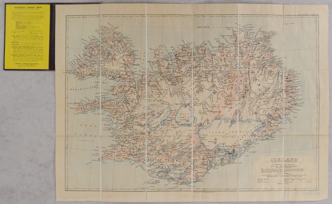
This detailed map of Iceland was originally published by the Royal Geographical Society in The Geographical Journal. It was published to accompany a paper presented by the Icelandic geologist and geographer Dr. Thorvaldur Thoroddsen (1855-1921). From 1881 to 1898, Thoroddsen gathered data on Iceland's geology and worked to update and correct the groundbreaking Bjorn Gunlaugsson map, which lacked detail in the central highlands. In 1901, he completed his comprehensive geological map. This map, published two years earlier, is something of a preview of his work-in-progress. Its coastline is sourced from the Admiralty Charts and the interior is based on Gunlaugsson, with improvements from Thoroddsen. The map is attractively colored in blue and brown to show the topography of glaciers, lava fields, and mountains. Churches and seats of justice are located. Dissected and backed in linen and bound in original boards with labels.
References:
Condition: B+
Lightly toned with a few faint spots. The boards are lightly sunned at top with bumped corners and minor wear; the label has light foxing.