Catalog Archive
Auction 193, Lot 376

"Il Chili con le Contrade Vicine ed il Paese dei Patagoni Delineati Sulle Ultime Osservazioni", Cassini, Giovanni Maria

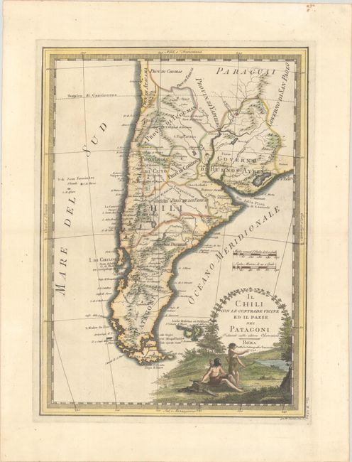
Subject: Southern South America

Period: 1798 (dated)

Publication: Nuovo Atlante Geografico Universale

Color: Hand Color

Size:
13.8 x 19 inches
35.1 x 48.3 cm
Download High Resolution Image
(or just click on image to launch the Zoom viewer)

This uncommon and finely engraved Italian map covers South America from Asuncion south to Cape Horn. The region is divided into various provinces, including Provin di Tucuman, Governo di Buenos Ayres, Chili, and Patagoni. Several cities are identified, including Buenos Aires, Santiago, Cordoba, and Monte Video. Volcanoes are depicted among the fine topographical detail, and the Pampas are indicated. I. di Chiloe, the Falklands, and several smaller offshore islands are located. The striking title cartouche features a scene of two Indigenous figures with bows and quivers.

References: Phillips (Atlases) #670 Vol. III #34.

Condition: A

A sharp impression on a sturdy sheet with a Strasbourg Bend watermark and a few small printer's creases.

Estimate: $275 - $350

Sold for: $200

Closed on 6/21/2023

Archived