Catalog Archive
Auction 193, Lot 371

NO RESERVE

"Carte Particuliere du Perou, Plan de la Ville de Lima, Description de Quelques Plantes, Animaux, & Machines du Pays...", Chatelain, Henry Abraham

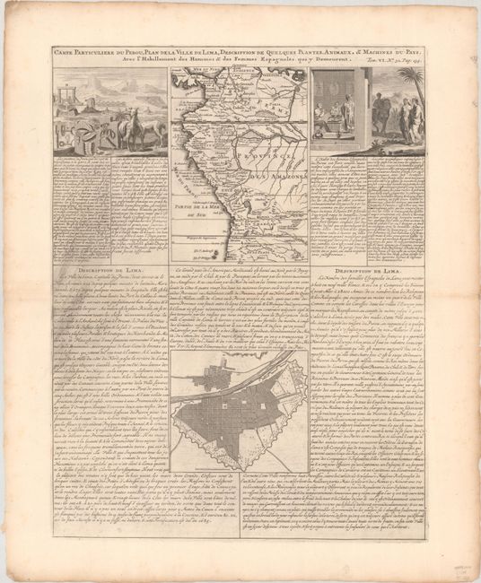
Subject: Western South America, Peru

Period: 1720 (circa)

Publication: Atlas Historique

Color: Black & White

Size:
14.8 x 19.6 inches
37.6 x 49.8 cm
Download High Resolution Image
(or just click on image to launch the Zoom viewer)

This interesting folio sheet contains two maps and two engravings surrounded by panels of French text. The top map covers the northwest coast of South America from Panama to northernmost Chili, with detail of towns, rivers, and mountain ranges. The map is flanked by two engravings depicting the people, tools, animals, and plants of the region. At bottom is a bird's-eye plan of Lima showing its fortifications.

References:

Condition: A

A dark impression with some printer's ink residue in text at left and minor toning and foxing along the edges of the sheet..

Estimate: $100 - $130

Sold for: $35

Closed on 6/21/2023

Archived