Subject: Lesser Antilles
Period: 1663 (circa)
Publication: Le Grand Atlas...
Color: Hand Color
Size:
21.1 x 16.4 inches
53.6 x 41.7 cm
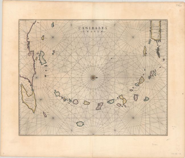
This is the first Dutch map to focus on the Lesser Antilles. It covers the Windward and Leeward Isles from Puerto Rico to Trinidad and Margarita. Centered on a compass rose with north at right, the chart is less decorative than other maps by Blaeu, having instead a practical navigational chart appearance. The title - Islands of the Cannibals - is certainly evocative. It illustrates the European impression of the mysterious islands of the New World resulting from many explorers' accounts of the savage Caribbean warriors who devoured their prisoners. Blaeu's map appeared only in editions of the great Atlas Maior from 1662-1670, thus it is relatively uncommon. French text on verso.
References: Goss (Blaeu) #70; Van der Krogt (Vol. II) 9640:2.
Condition: A
A dark impression on a wide-margined sheet with a large watermark of the god Atlas. There are minor remnants of hinge tape on verso and a couple of soft creases along the edges of the sheet.