Subject: Caribbean
Period: 1656 (dated)
Publication: Cartes Generales de Toutes les Parties du Monde…
Color: Hand Color
Size:
21.7 x 15.3 inches
55.1 x 38.9 cm
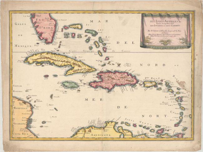
This beautiful map of the Caribbean covers from the tip of Florida to the western coast of Central America and the northern coast of South America. It shows excellent detail of the Bahamas, Cuba, Jamaica, Hispaniola, Puerto Rico, and the Windward Islands. Cape Canaveral, Havana, Santiago de Cuba (S. Iago), Santiago De Los Caballeros (also S. Iago), Santo Domingo, San Juan, Cartagena, and Coro are located along with many other towns and cities. The map is decorated with a delicately engraved, drape-style cartouche. Engraved by Jean Somer.
References: Pastoureau, SANSON V [89].
Condition: B+
There is a small stain along the right border and a centerfold separation at bottom that extends 1.5" into the image that has been closed on verso with archival materials. The blank margins have some soiling, creasing, and small edge tears.