Catalog Archive
Auction 193, Lot 293

"Plan von Pittsburg und Umgebungen",

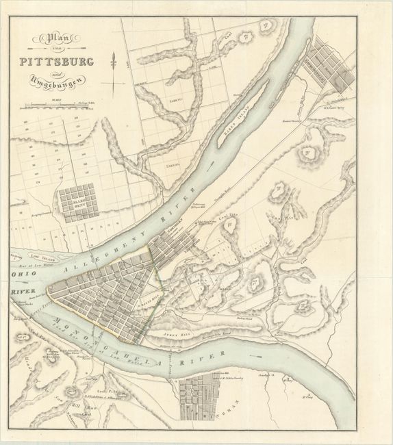
Subject: Pittsburgh, Pennsylvania

Period: 1828 (circa)

Publication: Reise Sr. Hoheit des Herzogs Bernhard zu Sachsen-Weimar-Eisenach durch Nord-Amerika...

Color: Hand Color

Size:
10.2 x 12.1 inches
25.9 x 30.7 cm
Download High Resolution Image
(or just click on image to launch the Zoom viewer)

This detailed map of the Pittsburgh region was published in a German book describing the travels of Prince Carl Bernhard in North America during 1825-26. It shows the street grid pattern of the city along with the numerous coal pits in the surrounding area. The map identifies a number of other points of interest including taverns, a glass works, a paper mill, and more. Despite the German title, all place names are in English.

References:

Condition: B+

Issued folding with a few short fold separations that have been closed on verso with archival tape.

Estimate: $220 - $250

Sold for: $160

Closed on 6/21/2023

Archived