Subject: Oklahoma & Colorado
Period: 1872-79 (dated)
Publication:
Color: Hand Color
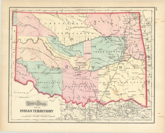
A. Gray's Atlas Map of Indian Territory, by O.W. Gray, dated 1872 (15.0 x 12.0"). This handsome map of the territory is divided among the major tribes including the nations of the Kiowa, Comanche & Apache, Chickasaw, Choctaw, Creek, Cheyennes, Cherokee, and several more. Three treaties ceding lands to the United States are noted in the western portion of the territory. A small nub of the panhandle is noted "Public Lands." This map was printed from Colton's plate, and was registered by G.W. & C.B. Colton in 1872. Condition: There are a few small spots in the image. (B+)
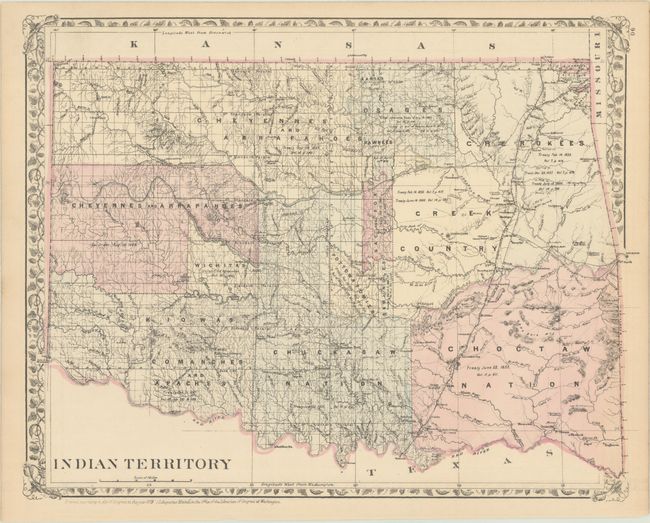
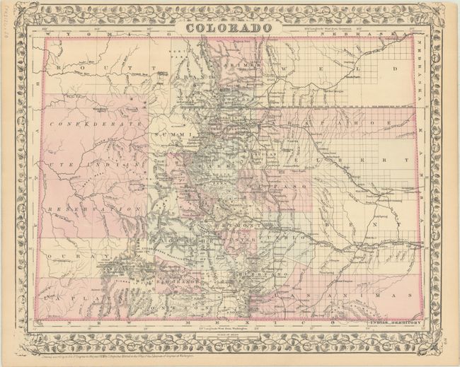
B. Indian Territory [on verso] Colorado, by Samuel Augustus Mitchell, dated 1879 (14.6 x 11.4"). Finely engraved map that shows about two-thirds of the territory has been surveyed and does not include the Public Lands in the panhandle. Filled with details of watershed, towns and villages, railroads, forts, military reservations, and treaties. On verso is a detailed map of Colorado showing the status of settlement and development only three years after becoming a state. It presents railroads, cities, towns and mining communities, watershed, forts, and more. The large Confederate Ute Indian Reservation takes up much of the western part of the state. This is one of the few Mitchell atlas map years showing Colorado separately. Condition: There is a hint of toning along the sheet edges, otherwise fine. (A)
References:
Condition:
See description above.