Subject: Southern Colorado & Northern New Mexico
Period: 1876-79 (dated)
Publication:
Color: Black & White
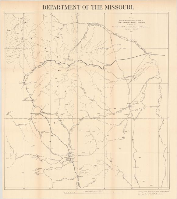
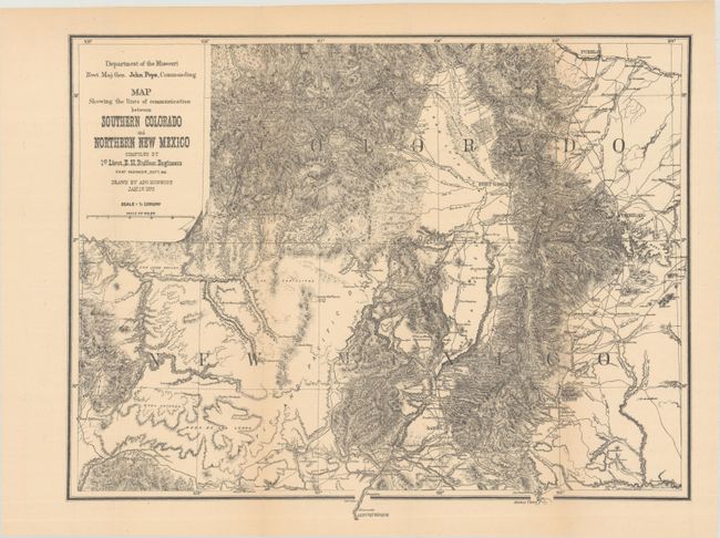
Two maps of Southern Colorado/Northern New Mexico by E.H. Ruffner:
A. Sketch Showing Military Roads Leading To Fort Lewis, Pagosa Springs..., dated 1879 (21.1 x 22.5"). This is the rarest of Ruffner's survey maps of southwestern Colorado and northwestern New Mexico. The area mapped is bounded on the north and east by the Rio Grande del Norte. To the west the map extends to Fort Lewis and Pagosa Springs and south into New Mexico past a cluster of settlements including Park View, Los Brazos, Old Fort Lowell, La Puente and Las Nutritas (sic). A road indicated with a dark line runs from Alamosa to Pagosa and south into New Mexico heading towards El Rite and Albuquerque. Several other roads cross the region, including the Chama and Conejos Toll Roads. Waterways are named, but topography is not shown, however random elevations are given. Drawn on a scale of four miles per inch. Tracings are attributed to maps from the Geographical Surveys West of the 100th Meridian.
B. Map Showing the Lines of Communication Between Southern Colorado and Northern New Mexico, dated 1876 (18.8 x 14.6"). This map depicts the region from Pueblo south to Albuquerque and from Fort Defiance to just east of Trinidad. Locates Santa Fe, Taos, Fort Garland, Fort Wingate, Las Vegas, and Trinidad along with detailed topography, watering holes, pueblos, wagon roads, and much more. The map was issued at the conclusion of Ruffner's 1873 expedition into Ute Country to quell the unrest between the Ute Indians and the prospectors in the newly discovered San Juan Mining Region.
References:
Condition: A
Issued folding on clean sheets with a hint of toning along the fold lines. The toning appears more pronounced in the scanned image than on the actual maps themselves.