Subject: World
Period: 1744 (dated)
Publication:
Color: Hand Color
Size:
16.8 x 13.1 inches
42.7 x 33.3 cm
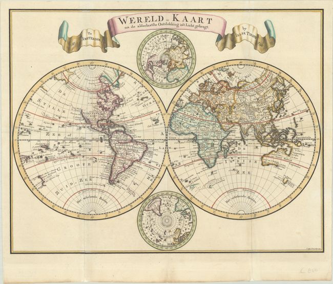
Handsome double hemisphere map with polar projections tucked between the spheres at the top and bottom. The Western Hemisphere shows the entire Northwest coast of North America blank with only the western shore of New Zealand mapped. In the Eastern Hemisphere, Nieuw Holland is shown for Australia with only the northern and western coastlines, which are connected to New Guinea. Tasmania (Van Diemens Land) is shown just below with several place names. The map is titled with a large, ribbon-style cartouche. Engraved by C. Sepp.
References:
Condition: B+
A crisp impression with full contemporary color on a bright sheet with a Strasbourg Lily watermark. Issued folding, now pressed with folds professionally reinforced with archival tissue. There are some small areas of loss on the fold intersections with minute loss of image.