Subject: Connecticut & Rhode Island
Period: 1796 (circa)
Publication: The American Universal Geography
Color: Hand Color
Size:
13.2 x 7.6 inches
33.5 x 19.3 cm
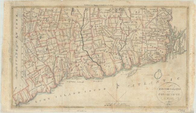
This early map of Rhode Island and Connecticut was published in Morse’s The American Universal Geography. The map depicts counties, townships, rivers and numerous small lakes and ponds. In the west the Oblong is shown, which was a 2 by 50 mile stretch of land given to New York in return for Connecticut’s boundary extending westward along Long Island Sound. Drawn by Harding Harris and engraved by Samuel Hill.
References: McCorkle (18th C. Geography Books) #304-6; Wheat & Brun #287.
Condition: B
Issued folding with light toning, moderate foxing and archival repairs to several fold separations. There is show-through along the left border of a previous owner's eagle stamp on verso. Small remnants of framing tape along the edges of the sheet on recto.