Subject: United States
Period: 1903 (dated)
Publication:
Color: Printed Color
Size:
34.3 x 39.5 inches
87.1 x 100.3 cm
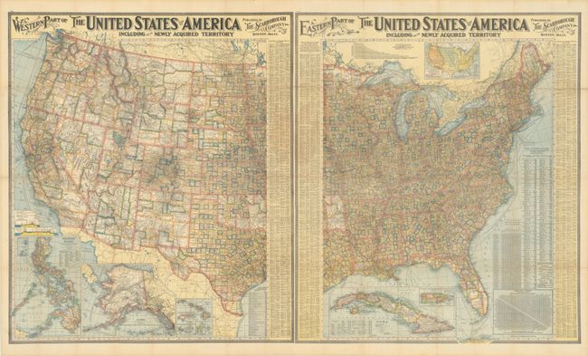
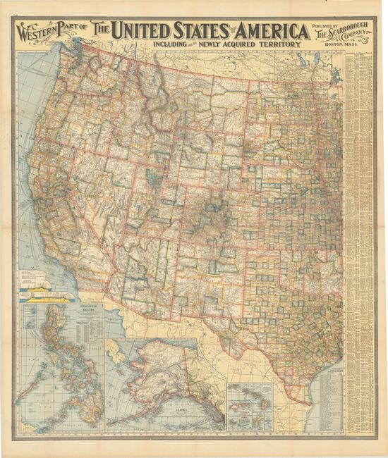
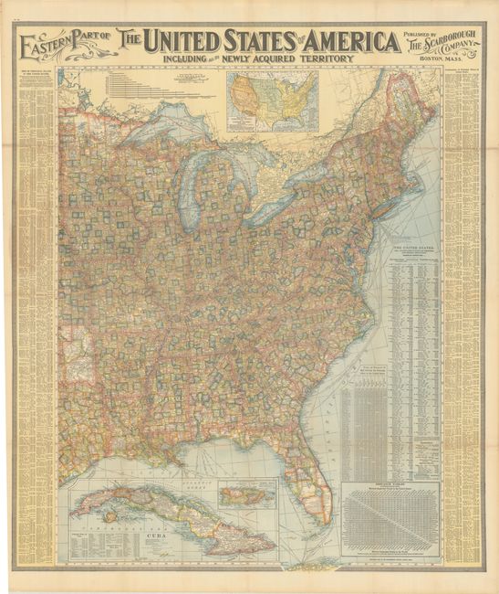
This uncommon pair of wall maps cover the Eastern and Western United States. There is incredible detail throughout showing roads, towns and villages, railroads, watershed and topography. Each county in every state is individually colored. Both feature fancy Victorian titling, a decorative keyboard-style border and are beautifully engraved. The Western sheet has large insets along bottom of Alaska, Hawaii and the Philippines. The Eastern sheet has a large inset of Cuba and a thematic map showing the territorial growth of the United States from 1776-1902.
References:
Condition: B+
Brightly colored examples, issued folding with tiny holes at some of the fold intersections that have been closed on verso with tape, several short fold separations, light toning along a few folds, and small remnants of hinge tape on verso. The first image is a composite image - the map is in two separate sheets.