Subject: United States, Civil War
Period: 1861 (dated)
Publication:
Color: Hand Color
Size:
24 x 17.5 inches
61 x 44.5 cm
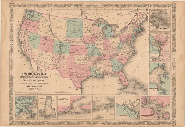
This is the more desirable issue of this Civil War period map, with the state and territory borders instead of the Military Districts. The large western territories include Dakota, Idaho (incorporating present-day Wyoming and Montana), and a truncated Nevada with Arizona encompassing the region containing Las Vegas. Hundreds of military forts are located. The map has at bottom and right nine inset plans of the major towns and harbors including Hampton Roads, Charleston Harbor, Key West, Baltimore, and Washington. Texas's ports are omitted, despite the ongoing naval blockade and Galveston's Union occupation and recapture by the Confederacy. Copyright date 1861, but published circa 1864.
References: TX GLO pp. 226-27.
Condition: B+
There is light offsetting, a few spots of foxing, and a pair of dampstains in the side margins.