Subject: East Indies - Indonesia
Period: 1780 (circa)
Publication: Atlas de Toutes les Parties Connues du Globe Terrestre
Color: Hand Color
Size:
12.5 x 8.4 inches
31.8 x 21.3 cm
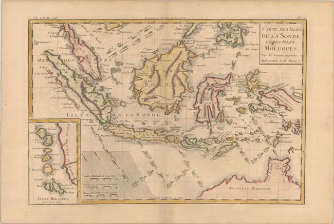
Great little map focused on the islands of Java, Sumatra, Celebes, Borneo, New Guinea as well as the tip of Australia's northern coast named as both Terre de Diemen and Terre d'Arnheim. Jakarta is Batavia and the engraver has placed Palembang in norhtern Java, hundreds of miles south of its actual location in Sumatra. Interesting notations depict the directions of the winds during the various months of the year. There is an inset map of the Moluccan Islands - the famous Spice Islands. The map has a rectangular title cartouche and three distance scales.
References:
Condition: B+
A crisp impression on a lightly toned sheet with a bunch of grapes watermark, minor offsetting and a few spots of foxing.