Subject: China, Korea & Japan
Period: 1661 (published)
Publication: Introductionis in Universam Geographiam
Color: Hand Color
Size:
7.6 x 5.3 inches
19.3 x 13.5 cm
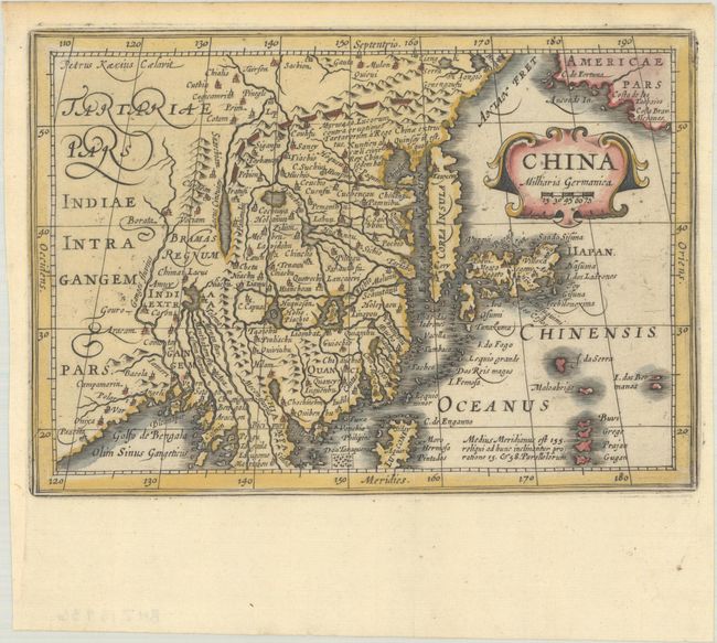
This handsome map of the region is based on the folio map by Jodocus Hondius and was designed for the Atlas Minor, first published in 1628. The eastern part of China (bounded in the north by the Great Wall) is dominated by several large lakes and major rivers. Korea is depicted as a strangely shaped island. The three main islands of Japan are shown below the strapwork cartouche. Americae Pars appears in the upper right corner separated from Asia by a narrow Anian Strait. Engraved by Petrus Kaerius. This map was originally engraved for the 1628 edition of Jansson's Atlas Minor and then published in this edition of Cluver's popular geography.
References: Van der Krogt (Vol. III) #8410:352.1.
Condition: A
A sharp impression with light toning along the edges of the sheet.