Subject: Southern Italy
Period: 1755 (circa)
Publication: Atlas Universel
Color: Hand Color
Size:
23.4 x 18.9 inches
59.4 x 48 cm
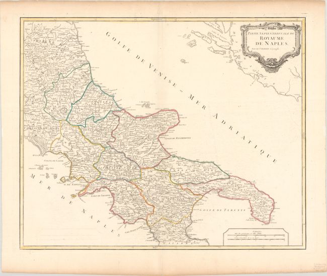
Very handsome map of the Royaume de Naples shows Italy's Adriatic Sea coast from Ancona south to Pescaro and the Isle de Tremin off the coast, and the Golfe De Manfredonia, Brindisi, Otrante and the Gulf of Taranto. Includes Italy's southwest coast from the Golfe De Gaete, and the Gulf of Naples depicting the town and harbor of Naples. Below that region the map shows Salerno and the Gulf of Salerno and the coastline to the Gulf of Policastro. The map is dotted with hundreds of place names of cities, towns and villages, along with mountain ranges and rivers and boundary lines of Divisions and Ecclestical Departments. The map was drawn and engraved under the direction of Gilles Robert de Vaugondy (1688-1766) one of France's foremost cartographers and engravers.
References: Pedley #360.
Condition: A
Contemporary outline color on a bright sheet with the watermark of a Maltese cross encircled in rosary beads. There is minor offsetting, a few short tears confined to blank margins, and light toning along the edges of the sheet.