Subject: Eastern Austria
Period: 1695 (circa)
Publication:
Color: Hand Color
Size:
23.3 x 18.3 inches
59.2 x 46.5 cm
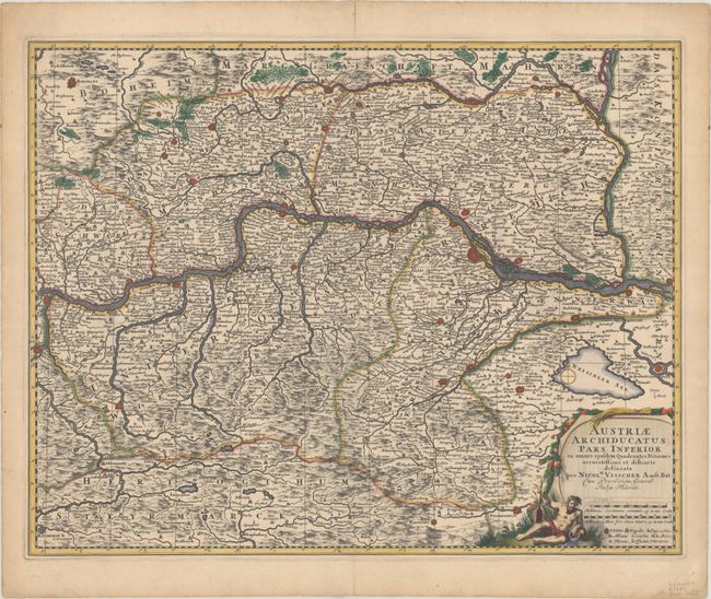
This handsome map details Lower Austria, along the course of the Danube River, and features numerous place names, towns, cities, villages, churches, and topography. Vienna, Baden, and many other fortified cities are located. The map extends south to show Pinkhenfeldt, north to include Borowany, Znaym, and Nicolspurg, east to Altenburg, Wolfstaal and Presburg, and in the west is Ens. The large title cartouche includes a river god with an oar and overflowing urn, two distance scales, and legend.
References:
Condition: B+
A sharp impression with contemporary outline color and later color in the cartouche. There are archival repairs to a tiny tear by Steyr and short centerfold separations at top and bottom, as well as a few short edge tears, and some remnants of paper tape on verso.