Subject: Lake Neuchatel, Switzerland
Period: 1715 (circa)
Publication:
Color: Hand Color
Size:
25.2 x 18.9 inches
64 x 48 cm
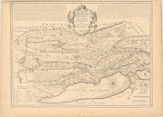
This striking map covers the region north of the Lake of Neuchatel. It is based on geometrical observations by the Nuremberg engineer David François de Merveilleux (1652-1712). The map is finely engraved to show abbeys and monasteries, castles, battlefields, mineral springs, forests, roads, cities, and towns. Relief is shown pictorially, and the map is oriented with north toward the upper right by a large compass rose. Lengthy historical and geographical notations are on either side of the magnificent title cartouche. Engraved by HenriLiebaux.
References:
Condition: B+
Contemporary outline color on a watermarked sheet with a few scattered spots in the image, a small worm hole at top right, and soiling along the top and right edges of the sheet. Narrow top margin, as issued.